In this guide
Kids learn geography best when maps are vivid, durable, and easy to read. This guide features five top-rated world and US map posters designed for classrooms, playrooms, and homeschooling spaces. Each option emphasizes clear labeling, age-appropriate visuals, and sturdy construction to support ongoing exploration of continents, countries, and states. Below, you’ll find a quick overview table, followed by detailed product sections and a practical buying guide.
| Product | Size | Lamination |
|---|---|---|
| Laminated World Map & US Map Poster Set (Palace Learning) | 18″ x 29″ | Laminated |
| World Map Poster & US Map For Kids (Momo & Nashi) | 24″ x 16″ | Not specified |
| 2 Pack World & USA Map For Kids (Palace Learning) | 18″ x 29″ | Laminate option available |
| 2 Pack Laminated World Map & USA Map Set (Palace Learning) | 18″ x 29″ | 3 MIL Lamination |
| Laminated World Map Poster (Blue) (Palace Learning) | 18″ x 29″ | Laminated |
Laminated World Map & US Map Poster Set
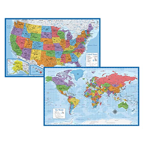
Designed for durability, this two-in-one set includes a world map and a United States map. The lamination increases tear resistance, making it suitable for busy classrooms and interactive learning spaces. The design emphasizes clear, legible labeling, helping young students connect continents with the U.S. states and major geographic features. Ideal for wall display in learning corners, libraries, or homeschool rooms where map exploration is ongoing.
World Map Poster & US Map For Kids 2pc Set
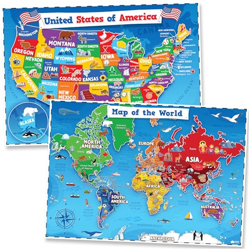
This two-poster bundle serves as a bright classroom staple for early learners. The world map helps kids identify continents and oceans, while the United States map introduces states and major landmarks. The posters are sized to fit common classroom bulletin boards and playroom walls, making it easy to incorporate daily geography activities, memory games, and labeling exercises into routines.
2 Pack World & USA Map For Kids [Illustrated] (18″ x 29″)

Illustrated maps capture young imaginations with friendly icons and bright colors designed to reduce distractions while improving recognition. These 18″ by 29″ posters are durable enough for ongoing use in busy classrooms and homes. The set supports early geography learning by linking continents, countries, and U.S. states with memorable symbols that aid memory retention and visual learning.
2 Pack Laminated World Map & USA Map Set

This set emphasizes the Equal Earth design, which presents continents at true relative size to improve geographic accuracy. Each poster measures 18 by 29 inches and features three-millimeter lamination for added durability. The design supports comparisons of landmasses and enhances spatial reasoning as students learn about the world and the United States in parallel.
Laminated World Map Poster – Earth 18″ x 29″ (Blue)

This blue-themed laminated world map provides a clean, outline-focused display that’s ideal for labeling practice. The laminated surface resists wear and tear from writing, sticking, or interactive activities. It’s a straightforward option for classrooms seeking a simple, visually calm reference map that can be augmented with student-made labels and notes.
Buying Guide
Key purchase considerations help ensure the chosen maps meet educational goals and space constraints:
- Size and visibility: Larger posters (such as 24″ x 16″ and 18″ x 29″) suit classrooms and play areas where multiple students read from a distance, while smaller formats work well for home learning corners.
- Durability: Laminated maps resist tears and smudges, supporting sustained use by kids who frequently handle materials. Three-mil or thicker lamination offers sturdier wear resistance.
- Design and labeling: Maps with clear country and state labels, consistent typography, and legible legends improve memorization. Some sets use illustrated icons to engage young learners without overwhelming them.
- Geographic accuracy: Poster suites that present continents in approximate relative size (Equal Earth design) help children understand scale and spatial relationships more accurately than some traditional projections.
- Pairing options: Sets that combine world and US maps enable cross-referencing geography topics—useful for integrated lessons on continents, oceans, and U.S. states.
- Versatility: Consider maps that can be used in homes, classrooms, or homeschool spaces. Durable, easy-to-clean surfaces facilitate interactive activities like labeling, quizzes, and wall-mounted games.
- Aesthetic fit: Colorful images and balanced color palettes keep kids engaged without overstimulation. Neutral backdrops with bright accents reduce visual clutter in busy rooms.
Teaching strategies to maximize learning with these maps include labeled route planning (e.g., tracing travel paths across continents), memory games (matching countries to capitals or landmarks), and periodic update activities (adding new facts as students explore). Accessibility features such as large print, high-contrast colors, and simple legends can benefit younger learners and students with diverse needs.
In summary, the selected poster sets offer durable, visually appealing, and educational options for helping children understand world geography and U.S. geography. By pairing a world map with a U.S. map, teachers and parents can create a cohesive, interactive geography center that supports foundational literacy and spatial reasoning.